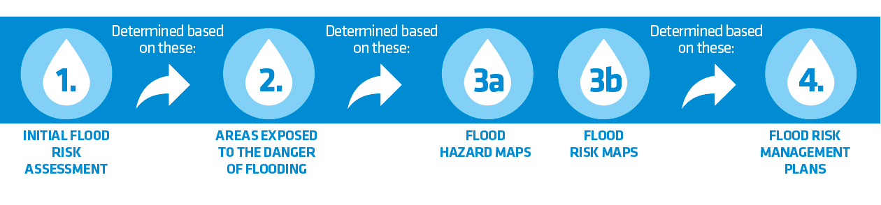


What is a preliminary flood risk assessment (PFRA)?
A preliminary flood risk assessment (PFRA) is the first of the four planning documents required over the 6 year cycle defined in the Directive 2007/60/EC of the European Parliament and of the Council of 23 October 2007 on the assessment and management of flood risk (Flood Directive).
The aim of the preliminary assessment of flood risk is to identify flood risk areas (FRAs), where flood risk is significant or where high flood risk is probable. Preliminary flood risk assessment is based on available or readily derivable information which includes:
- hydrography, topography, and land use;
- description of floods that have occurred in the past, and had significant adverse impacts on human health and life, the environment, cultural heritage and economic activity,
- assessment of potential adverse consequences of floods that can occur in the future,
- forecast of long term developments, particularly impacts of climate change on the occurrence of floods.
Areas of Potential Significant Flood Risk (APSFRs) identified in the preliminary assessment of flood risk do not provide the basis for spatial planning. The aim of a PFRA is not precise establishing of flood risk areas, but their preliminary identification.
Based on the results of the PFRA, in further documents of the planning cycle, areas are precisely defined, presented on flood hazard maps FHM (flood risk areas extent, water depths, water levels, as well as flow direction and velocity) and on flood risk maps FRM (extent of flood damage, number of inhabitants and potentially affected structures), and in consequence flood risk management plans are developed (FRMP). Only those documents provide the basis for introducing spatial policy on flood risk areas.
- Preliminary Flood Risk Assessment
- Areas of Potential Significant Flood Risk
- a) Flood Risk Maps
b) Flood Hazard Maps - Flood Risk Management Plans